Spotting Russian aircraft in satellite imagery
Satellite imagery shows that Russian aircraft regularly fly over occupied Ukraine
The Russian air force has played an active role in the invasion of Ukraine. From geolocated footage to satellite imagery, open source research techniques can offer insight into Russia’s air operations.
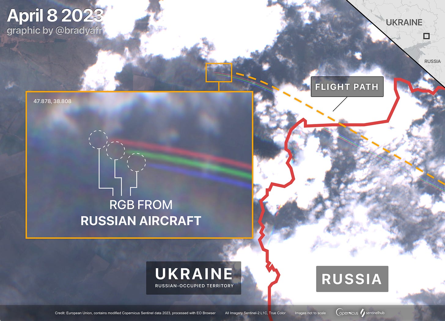
First, some background: when a satellite passes over a flying aircraft there is a distinct red, green, and blue signature left behind. This is due to a few factors such as the movement of the aircraft. The image below shows the effect and you can find a more detailed breakdown here.

In addition to this signature, some planes may create contrails that can be followed to find the aircraft itself. These partial flight paths can offer insight into where an aircraft may be based.
Finding aircraft in satellite imagery
Many commercial and military flights broadcast their location for aviation safety. This means that it is possible to use flight tracking websites to find an aircraft’s broadcasted location at a given time and then locate the aircraft within a satellite image.
When an aircraft’s operator is not identifiable through flight tracking sites such as Flightradar24 or ADS-B Exchange, the aircraft’s likely operator can be inferred by its location, flight path, reports from social media, or even geolocated footage from government sources.
Researchers have published algorithms that can automate the detection of aircraft (with varying accuracy). For manually locating aircraft in satellite imagery, it is easiest to search near high-traffic areas like airports or by looking for contrails that can lead to an aircraft.


